
×
Your location has been changed to Denver area.
This Event has Passed
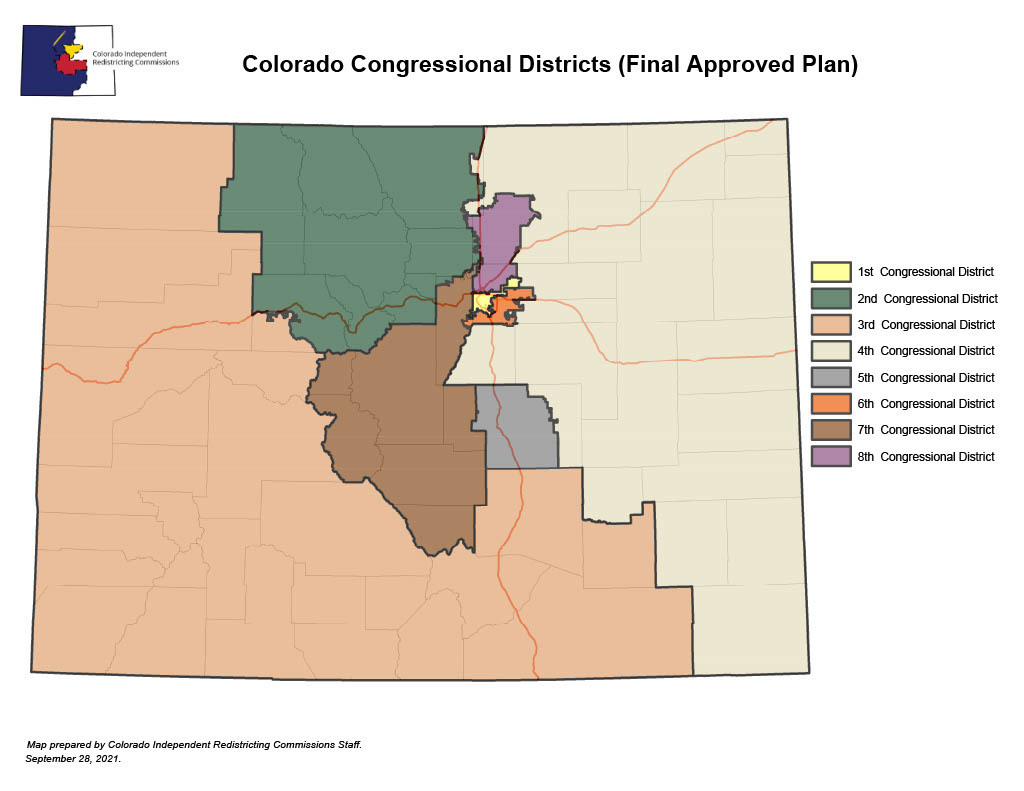
The Role of Maps in Electoral Redistricting: Redistricting Maps in Context
The Rocky Mountain Map Society is partnering with History Colorado to bring this presentation about the use of maps in redistricting. Electoral redistricting for congressional representatives takes place after the decennial census in the United States. Population data provides the basis for how many people should be grouped in each geographic area, while laws and regulations guide the decisions made by the people designated to draw district lines. While maps are central to this process, how the maps are constructed to represent the residents is dependent on choices made at state and local levels.
This presentation will examine redistricting in the context of 1) global approaches to geographic representation, 2) manipulation of districts to maintain power, and 3) current democracy reform projects in the United States.
Consider with whom you have been clustered in state or local legislative districts and how such grouping impacts legislative actions.
Event Links
Tickets: https://go.evvnt.com/2221714-0
Website: https://go.evvnt.com/2221714-2
